Hiking | A two-day camping itinerary of the MacLeHose Trail in Hong Kong
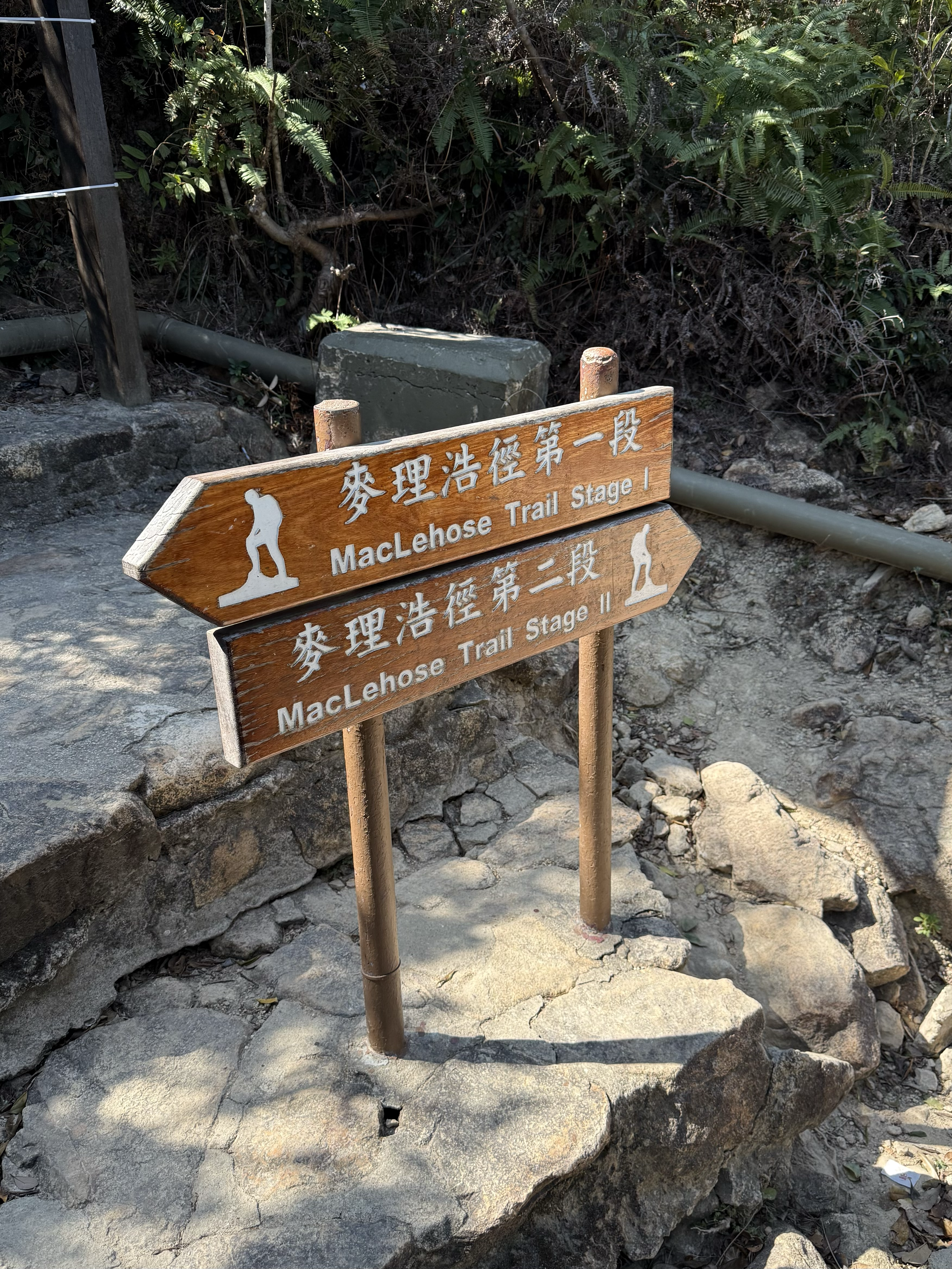
This post shares a two-day, one-night hiking and camping itinerary for Stage 2 and 4 of the MacLehose Trail in Hong Kong.
The main focus of this trip was to enjoy the scenery, and I didn’t complete the entire original route. Since I planned to camp at the Ngong Ping camp site(昂平营地) in Stage 4, known for offering one of the best views of both sunrise and sunset, my plan was to start with Stage 4, camping at Ngong Ping and then made my way to Stage 2——from the High Island Reservoir East Dam(万宜水库东坝) to Ham Tin Wan(咸田湾)——to take in some truly breathtaking sea views.
I originally planned to exit at Ham Tin Wan(咸田湾), but the store owner said the waves were too strong and no boats were available, so I switched to exiting from Sai Wan(西湾) instead.
The distribution of the route over the two days wasn’t perfectly balanced, but I’ve highlighted the supply points and exit points along the way for reference.
From Stage 4 Start to Ngong Ping Camp site
(around 7 km)
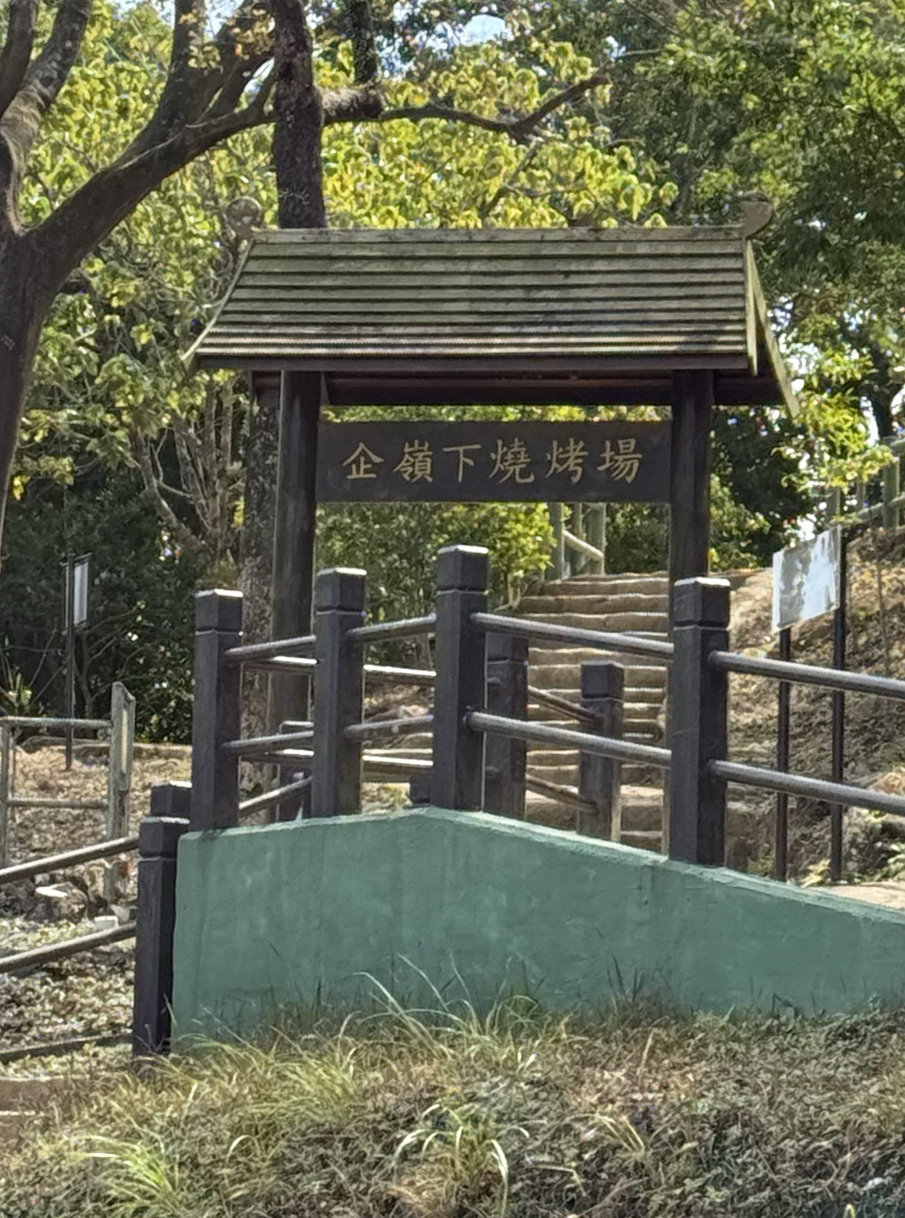
Take the KMB bus 299x to Shui Long Wo(水浪窝) bus stop. After getting off, walk around 200 meters to the stage 4 start point (there’s Kei Ling Ha barbecue area and a toilet)
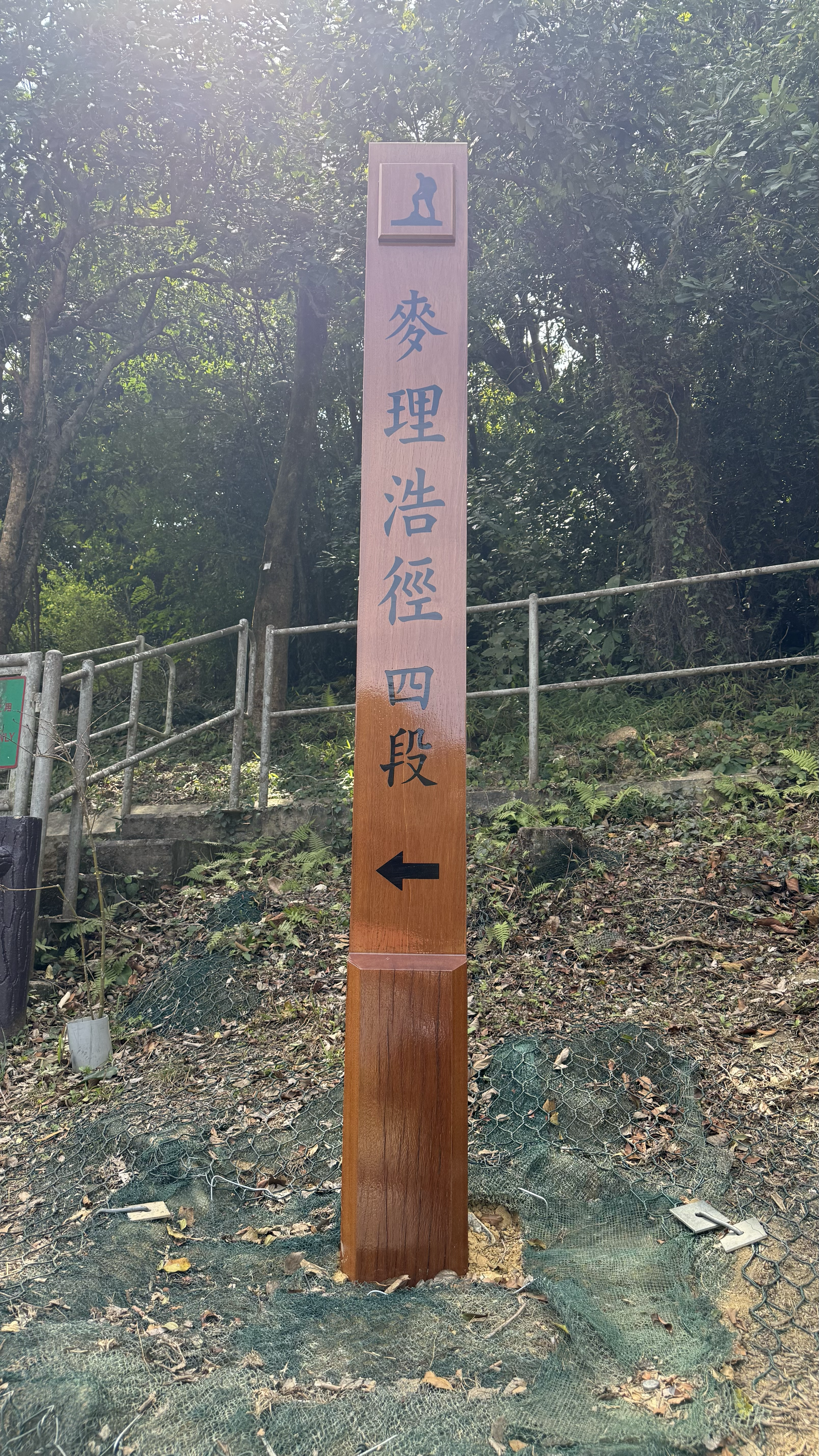
Stage 4 is mostly a mix of concrete paths, steps, and dirt trails. The stage along the ridge at higher elevations offers scenic views of the sea.
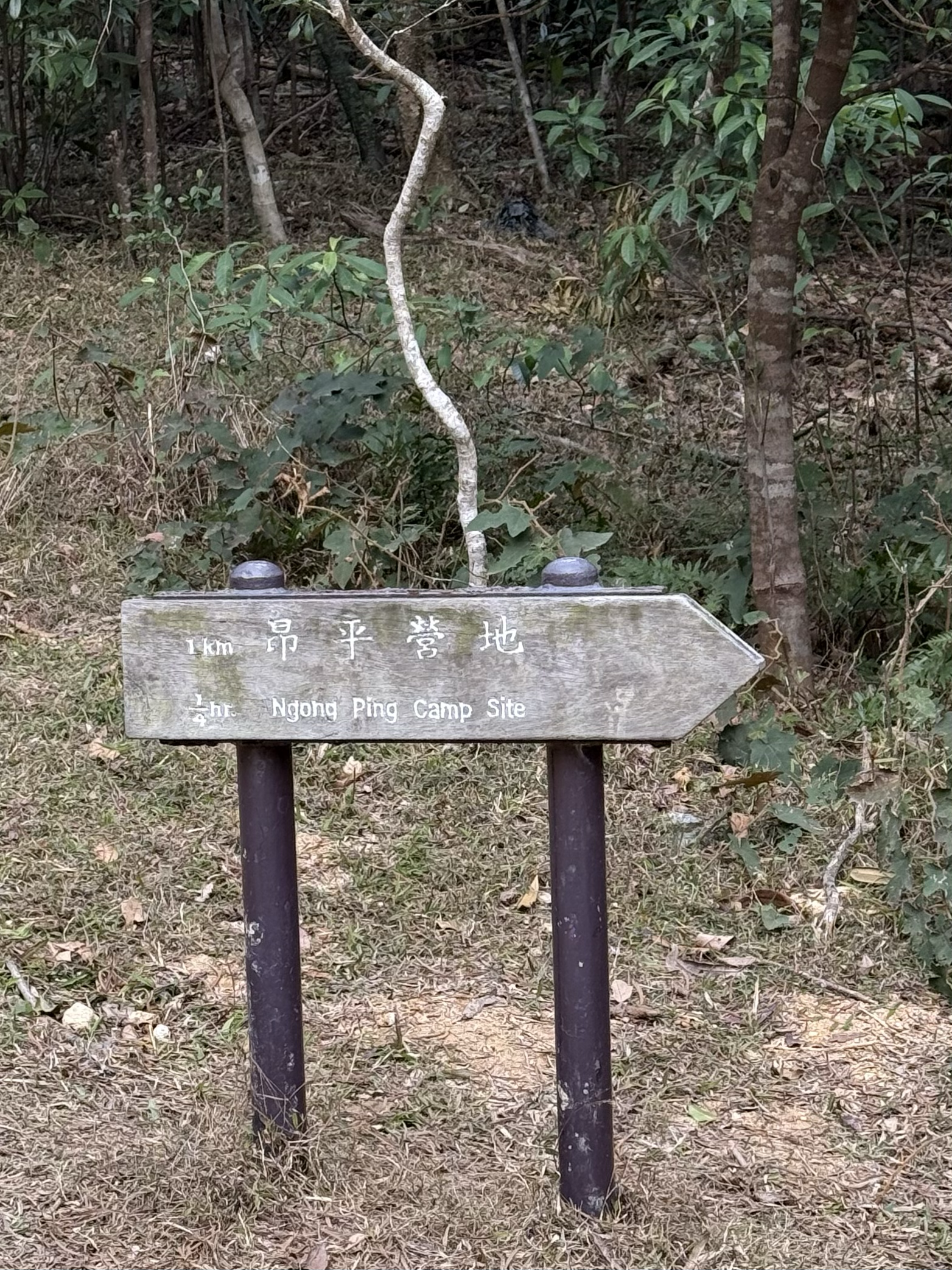
The Ngong Ping camp site is located between M082 and M083, about 7 km from the start point, which takes roughly 3 hours. There are no supply points along the way, so make sure to bring enough water and food.
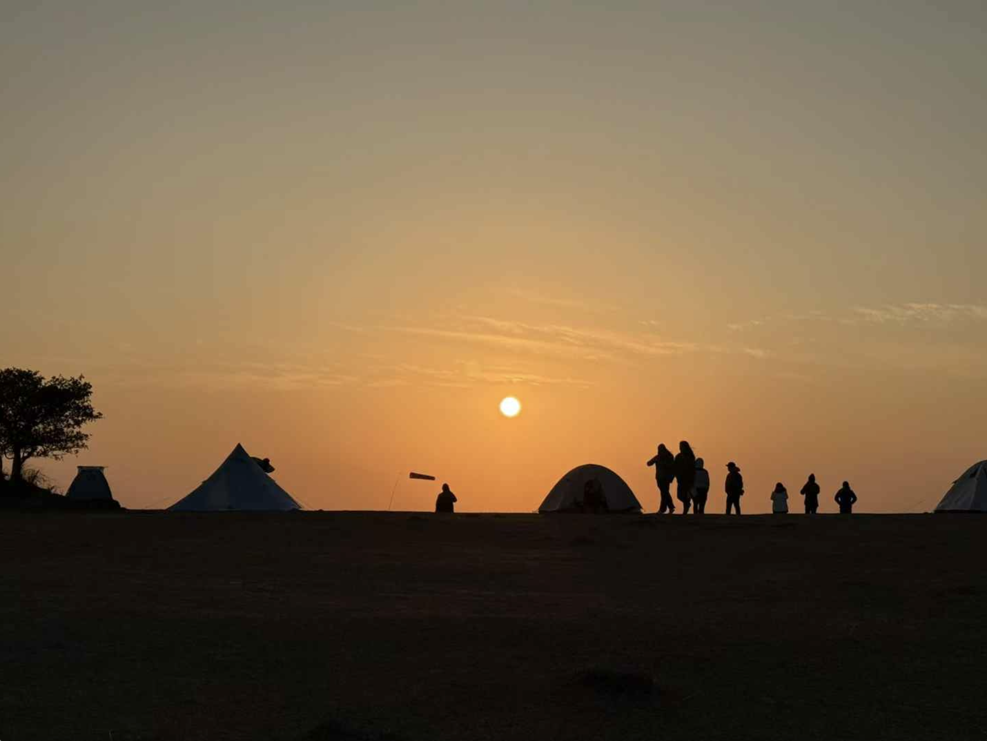
Once you see the camp site sign, continue a little further to reach the Ngong Ping Viewpoint, where you can enjoy views of the sea and both the sunrise and sunset. The official signage indicates that camping here is not allowed and you may be fined.
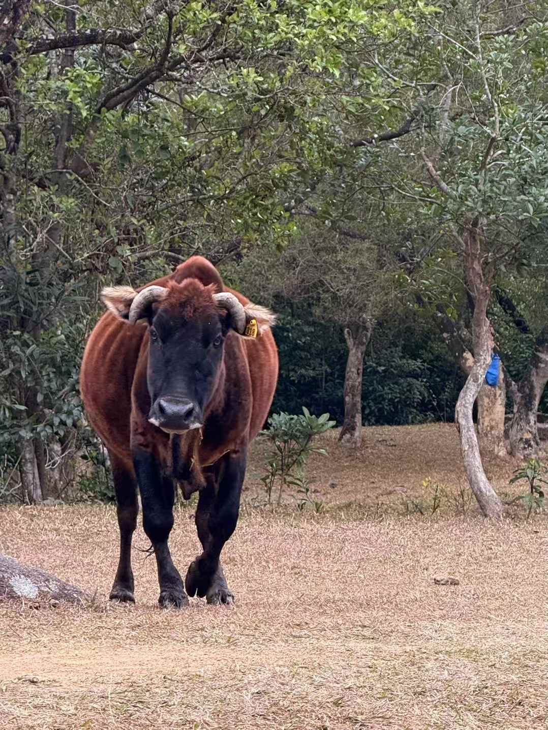
The Ngong Ping Viewpoint and camp site are located on opposite sides of the main trail. The camp site is relatively sheltered from the wind and is suitable for camping. There is a dry toilet, but no water source (the nearest stream is 1 km away). Wild cows and boars may pass through, so keep your food protected.
Ngong Ping to Tai Shui Leng
(around 3 km)
Return to the main trail from the Ngong Ping camp site and head toward Tai Shui Leng.
It takes around 30-40 minutes to descend to a residential area (there is a convenience store, but it may not be open, and it can be difficult to get a taxi).
Continue to walk to the main road, and you’ll reach Sai Kung Public Transport Interchange. (You can take a bus, a taxi, or resupply here.)
Sai Kung to Stage 2 Start
Take a taxi to the High Island Reservoir East Dam (about 30 minutes), or take Minibus 7, then transfers to 9A at Pak Tam Chung Bus Terminus(北潭涌总站). You can also take a taxi there, it’s easier to share a ride while there are always many people on the weekends, and a taxi from Pak Tam Chung Bus Terminus to the Eastern Dam costs around 100 HKD. Notice 9A runs only on weekends.
Stage 2 Start to Sai Wan
(around 6 km)
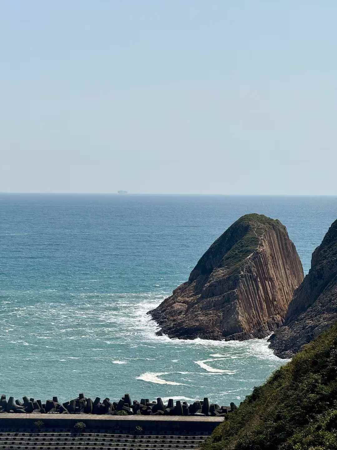
One end of the Eastern Dam is Po Pin Chau(破边洲), and the other end is the start of Stage 2.
After a short climb, you’ll reach the Stage 2 sign.
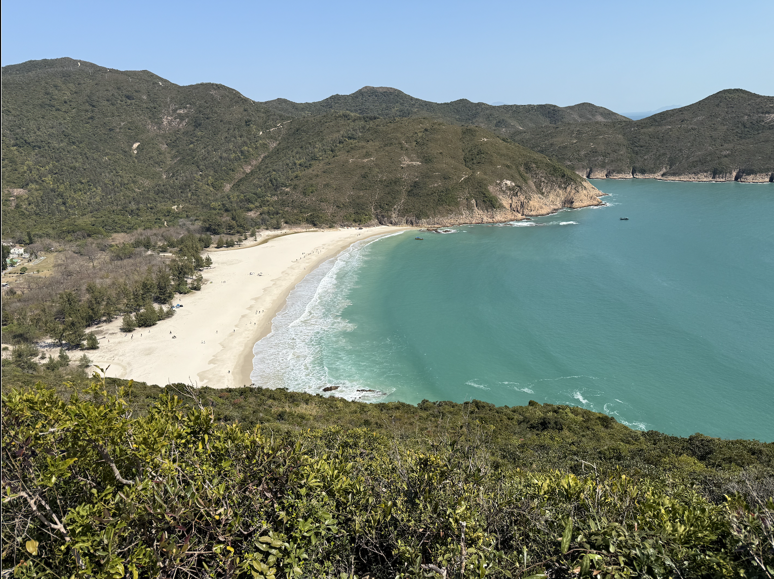
Stage 2 first passes through Long Ke Wan beach.
Then, it’s a steady climb to the top of Sai Wan, which has no shade and can be very sunny.
To Sai Wan Pavilion
(2 km)
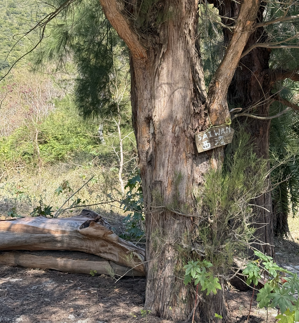
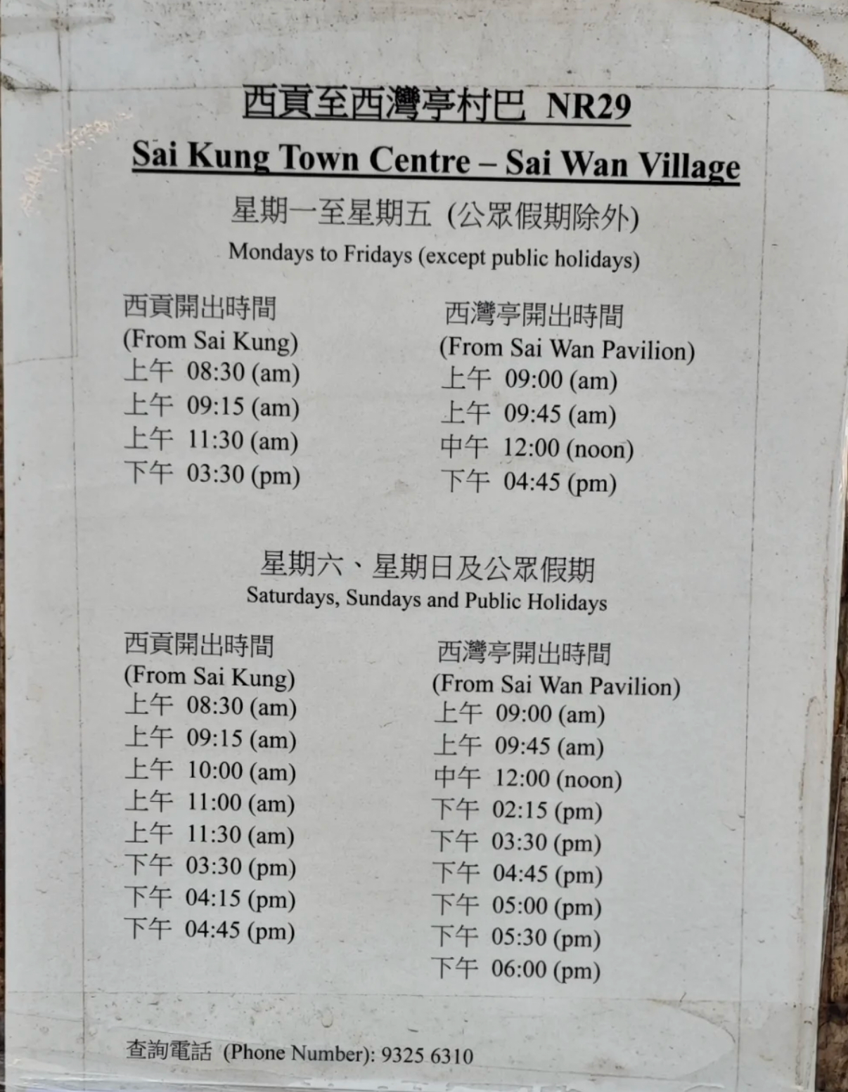
When you reach the Sai Wan junction, there’s a pavilion. This is a exit point.
Turn right to reach Sai Wan beach for a boat to Sai Kung or continue on Stage 2, or turn left and descend to Sai Wan Pavilion for a minibus to Sai Kung. You can pay the 19 HKD fare by cash or Octopus.
Notice, there’s no signal at Sai Wan Pavilion.
You can camp or resupply on Sai Wan Beach.
Remaining 10 km of Stage 2
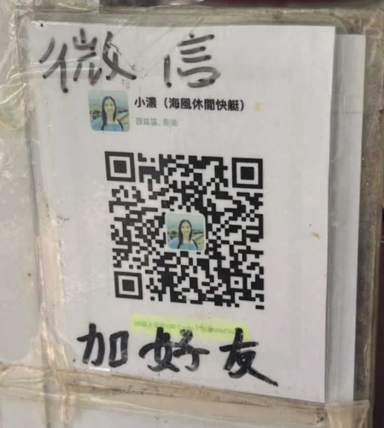
If you continue, you’ll reach Ham Tin Wan beach, where you can camp or resupply. You can also take a boat here back to Sai Kung. Notice, contact the store in advance to confirm boat availability for the day. +85223282315
If you go further, you’ll reach Chek Keng Pier, where you can also take a boat back. The end point of Stage 2 is at Pak Tam Au, about 2km from Chek Keng.
Hope you enjoy your hiking trip to MacLeHose Trail. :)
Other Hiking Stories
洛克日记 | 十月泸沽湖
洛克日记 | 向导尼莫
洛克日记 | 吃饭记
洛克日记 | 消失的洛克线
洛克日记 | 出山记
洛克日记 | 最后的香格里拉